


 Above: Dropping down Wildrose Canyon to Panamint Valley. Intermittent pavement.
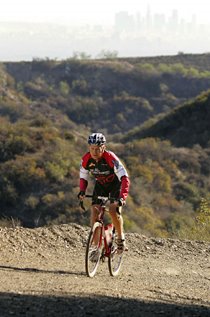
 Above: The Air Force at work, keeping close track of Rough Riders.
 Above: The psychedelic colors of Towne Pass.
Below is the route sheet, and a video slideshow, from a 64 mile loop we did on December 1, 2008 out in Death Valley National Park, both in Death Valley and Panamint Valley. There are only four miles of dirt and gravel road on this loop, so this ride is entirely rideable on a road bike with 25mm tyres, or even 23mm if you're careful (as we were).
We both rode our Ritchey Break-Away road bikes with Ritchey 700 by 23mm tyres, specifically the Ritchey Race Slick Comp model, which weigh in at 270 grams and retail for $27.99. These tyres ride great, last a long time, and we've practically never gotten a flat. These tyres are one of the best kept secrets of the bicycle industry, for some reason. My low gear was 38/28, while hers was 34/28. Both bikes are equipped with a full complement of Ritchey parts, plus Dura-Ace 10-speed shifting and brakes. (Shifters are 10-speed bar-ends in both cases.) These Break-Away bikes are simply amazing in just about every circumstance! More Info.
Whatever bike you use, this is simply a really nice - and extremely epic and dramatic - ride to do. The dirt road section through Wildrose Canyon has a nice, adventurous feel. It opens up to lovely views, and all along has vast quantities of silence. If you're lucky, you'll see some pink oleandars in bloom at the little oasis picnic spot in the canyon, a few miles above the Panamint Valley. (Look for one in the video slideshow). I had assumed those are the source of the name "Wildrose" but my local expert tells me that "oleanders are not native but seem to do well in the desert - we have a bunch of those at the Ranch. I think Wildrose is named after Cliff Rose (Purshi Mexicana) which is a white bloom that grows in the late spring to early summer in that area." Here is a very cool 360 degree view of that oasis.
There are also spectactular views of Telescope Peak, Mt. Whitney (if you look back while asecnding Townes Pass, about 2/3 of the way up), and much, much more. You may get "strafed" by military aircraft from Edwards Air Force Base, too. (Usually we see extremely fast, very low-flying fighter jets, but this time we saw something different. According to my Navy Pilot buddy Scott (who is also a Rough Rider and ultracyclist), "That's an MC-130 Combat Talon, amigo. ...One of Air Force Special Operations Command's (AFSOC) specops fixed wing support aircraft. It's a basic C-130 cargo plane that's heavily modified with all sorts of James Bondesque equipment that ostensibly allows it to penetrate at night/low level way behind enemy lines for special operations activities and combat search and rescue." (You'll see it in the video slideshow.) I could probably write 10,000 words about why I love this route and what makes it so special, but hopefully the photos will give you an idea.
Below is the route sheet. Bring a Death Valley National Park map for reference. Plan on about 7 to 8 hours, total time. Be sure to bring plenty of water and food as you will find no supplies, and essentially no people, on this route! (You can veer off-route about two miles to Panamint Springs Resort when you hit Hwy 190, if necessary. We had planned to do that, but were running out of sunlight so we skipped that and rode with limited water supplies while the late afternoon sun burned down upon us.) BTW, cell phones don't work out here!
In terms of planning your ride, this route is a loop, and it is possible to start the loop in many places, depending on convenience, where you're staying, or which direction you prefer to ride. We went clock-wise. The only issue there is that you therefore hit the "rough stuff" section on a downhill. Some people prefer to ride dirt roads in an uphill direction, rather than downhill, if given a choice. In our case, we literally hit the dirt section immediately behind a road grader, so that stretch was in particularly excellent condition. But I have ridden that dirt stretch (on Wildrose in the Panamint Valley) many times with many people on road bikes and have never had a problem. As I said above, on this ride we had 23mm tyres with no problems. Just pay attention, pick your line carefully, and slow down for the bigger rocks.
We started this ride at the little former Ranger Station and Rest Area on Hwy 190 near the Emigrant Pass / Wildrose Rd turn-off from Hwy 190. There is a bathroom there, plus good parking, a payphone, and a nearby undeveloped campground. This is six miles west of Stovepipe Wells.
0.0 Start on Hwy 190 going west / uphill (2060')
0.1 Left on Emigrant Canyon Road towards Emigrant Pass. (Road climbs 2000' in 6.5mi.)
13.8 Summit Sign, Emigrant Pass (5318')
15.4 True high point of the road (5440')
15.9 Pullout near Nemo Crest with dramatic view towards Telescope Peak, Nemo Canyon, and points south and southwest (360 Degree View)
21.5 Go right on Wildrose Canyon Road to Panamint Valley (straight goes to the famous Charcoal Kilns) (4040') Begin dirt section; may be wet.
25.5 Pavement Resumes
31.1 Right on Panamint Valley Road (1420')
45.1 Right on Hwy 190 east (or go west 2mi to Panamint Springs Resort for food and drink) (1700')
56.3 Summit, Towne Pass (4956')
64.1 Finish (2060')


No comments:
Post a Comment