


 Solvang and its setting, the Santa Ynez Valley, has been a favorite cycling region of mine for 30 years now. Today I rode a loop which I had never done before by piecing together a few different previously ridden routes and connecting them with one excellent 3.25 mile dirt road ascent.
The start/finish is the Santa Ynez Valley Coffee Company, in the corner of the Nielsen's Market parking lot adjacent to the intersection of Alama Pintado and Hwy 246. This is immediately east and downhill from Solvang's city center.
My Garmin 300xt clocked the route at 39.5 miles, though a Google Maps recon of the route the night before said it would be 44 miles (that Google route seems to throw in some short fire road sections in the mountains which don't exist, or aren't really part of this route). You can see all the stats below, but there's even more detail, not to mention the GPS file download, over on my Garmin page for the ride at this link.
It was a foggy day, so I didn't carry a camera or prioritize photography, even though it was still beautiful out. The mustard along both sides of the roadway during the descent to Refugio Beach was incredible, standing up to ten feet high. Above are the only two shoots I took, of my Rivendell Roadeo, as the pavement turned to dirt as the road started to pitch uphill on Refugio Road.
My gearing is 11/28 rear and 39/48 front with Dura Ace ten-speed. Tires are Challenge Paris-Roubaix (700 by 29mm). These were some of my first rides with the new Ritchey Classic Silver bars, stem, and seat post, as well as with the Berthoud "Touring" saddle and HandleBra leather bar tape, all of which I really like. A full post will follow soon about the Roadeo, which is now 99% "finished" and ready for all that awaits.
Route Sheet / Description:
0.0 Head east on Hwy 246.
1.9 Right on Refugio Road (traffic light at the SYV High School and YMCA).
Note: during and shortly after the rainy season, such as now, anticipate about eight water crossings. Since I have Honjo fenders, I was able to coast through them and not get my shoes or bike wet.
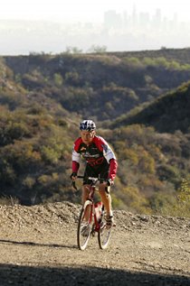
6.2 Pavement ends, but keep your ears pealed for the occasional jeep or enduro motorcyclist.The route is essentially all uphill at this point, and all dirt except for three 50-yard paved stretches. The road climbs about 2000 feet and my Garmin was claiming 10-15% grade most of the time. I passed a few mountain bikers along the way, but didn't encounter any cars.
9.5 Pavement resumes at the top of the mountains. Entrance to the former Reagan Ranch is on the right. Continue straight / right and generally downhill on Refugio Road all the way to the coast.
17.8 (app.) Enter the 101 north (right turn, up the ramp)
34.0 (app.) At the summit of the big ascent, look for and take a one-lane right turn downhill (rather than bombing downhill on the 101).
35.0 (app) Turn right on Alisal Road. You will pass Nojoqui Falls Park, a nice place for water, bathroom, or a break, or even a short ride/hike up to the falls.
39.5 (app). Finish where you started! Please support the local business(es) while you ponder your excellent ride!


3 comments:
Nice article, thanks for the information.
This looks to be a very interesting loop. I mapped this out on ridewithgps a while back & it had a bunch of confusing instrucitons. Is Refugio Rd clearly marked all the way or are there any "gotchas"? ridewithgps shows some Forest Service designations but I've found it in error on other roads.
just rode this today. Dirt section easy for my Cannondale EVO w 11/28 compact. Hardest part was down Refugio! 101section was newly paved and safe. I suggest this to anyone who likes to get away from it all.
Post a Comment