


 Mark your calendars and join us for a most excellent Rough Riding adventure! This semi-epic ride is planned for Sunday, July 5. The 58.4 mile loop we will ride starts and finishes at the relatively new Starbux located at 2963 Alpine Blve in Alpine, CA 91901 (along the I-8 corridor in eastern San Diego County). (Start location and mapping here.) We will meet there at 730am and roll out no later than 800am.
 The route will include the dirt sections (and some paved sections) from two different rides we've done out in this amazing area before. Basically we'll ride a sort of "Greatest Hits" route which includes the dirt sections at the start and finish of this route (click these links for the full reports, but also check out the videos embedded below):
http://www.xo-1.org/2008/12/rough-riding-eastern-san-diego-county.html
along with the entire dirt Boulder Creek section featured in this route:
http://www.xo-1.org/2009/01/rough-riding-south-eastern-san-diego.html
We're hoping you will mark your calendar and join us for an AWESOME ride!
Note: This ride is unhosted, unsupported, and everyone who shows up is on their own. Neither we, nor anybody else, is responsible for anyone who rides. If you ride, YOU are responsible for YOU and YOUR bike. This is not an "event" - it is just a ride on dirt and paved roads for like-minded people.
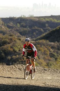
Recommended Bikes / Tyres: In our opinion and experience, this route all rideable on a road bike with 28mm or wider tyres, although we have used 32mm and 35mm tyres. The wider your tyres, the more comfortable and safer your ride should be. Certainly a full-blown mountain bike will work, too. "Any Bike, Anywhere!"
Route Sheet Is Below (If you plan to ride this route, we suggest you print this section and bring it along. We will not be "guiding" this ride, as we are not in charge, nor "hosting" this ride. This route sheet should be about 98% accurate, but we make no guarantees. We suggest you consult a map and your own sense of direction. We accept no responsibility for safety, utility, nor legality of this route!) Dirt sections are noted in bold.
0.0 Start at Starbux in Alpine and head east on Alpine Blvd. (El. 2080')
1.1 Cross over I-8 at West Willows Rd.
1.3 Continue east on the opposite (north) side of the freeway.
2.1 Veer left shortly thereafter on Viejas Grade Rd. into the Indian Reservation.
4.7 Road turns to gravel - head uphill into Rough Rider heaven!
8.6 Summit Viejas Grade (still gravel).
9.0 Pavement resumes: Continue straight and downhill to Descanso.
11.2 Left on Oak Grove Drive (at Perkins Store in Descanso: GET WATER!)
12.8 Right on Boulder Creek (but first check out the llamas on the left at the turn).
16.6 Pass Sherilton Valley Road (Need to investigate this road. Looks interesting.)
16.9 Pass Dubois Truck Trail on left (Need to also research this dirt road). (El. 2780')
17.9 Pavement ends! (El. 3340')
23.6 Bottom of the canyon. Careful for water running across the road. (El. 2500'; 2:30 elapsed time)
24.0 Pass Ranchita Margarita: watch for ostriches.
24.5 This is the very bottom of Boulder Creek Canyon, during 1/3 mile of pavement.
25.7 Pass two truck trails on the left at a hairpin. (Need to research them, too!) (El. 2780')
29.5 Tiny church and a cemetery on the right, within the Inaja Reservation.
29.8 Mile Marker 17. (El. 3630'; 3:40 elapsed time)
30.8 Pavement resumes: Right (uphill) on Engineers Road at Pine Hills Fire Station (where you can get water if you need it).
34.7 Summit.
36.0 Right on SR 79 (Stop Sign, T-Int.): Go around Lake Cuyamaca.
36.6 Lake Cuyamaca Store on left; Food and drinks for sale. Bathroom down and around in back. (El. 4410'; 4:50 elapsed time)
39.0 Pass the Paso Picacho State Park on right; begin descent.
44.3 Pass East Mesa Fire Road on left (Must research this dirt road!) (El. 3770')
45.0 Pass Oakzanita Springs / 1000 Trails on left. Bathroom and store.
47.7 Pass Viejas Blvd on right (or you take it and get to the same place after passing the Perkins Store in Descanso); fruit stand.
47.9 Right to continue on SR 79 (Stop Sign, T-Int.). (El. 3390')
49.3 Pass Riverside Drive (our outbound route earlier). (El. 3210')
49.8 About a mile before hitting the I-8, turn right on Wildwood Glen Ln (AKA "Mad Max Road").
50.8 About a mile later, there is a gate across the road and then the pavement starts to disappear: keep going to the end!
52.1 Hike down onto I-8 and continue west on I-8 (this is a bike-legal shoulder).
53.5 Take first offramp, then left over the freeway, then right on Alpine Blvd, continuing west back to Alpine.
56.8 Cross West Willows Rd. (the way we headed out this morning); continue straight west.
58.0 Finish at Alpine Starbux. (El. 2080'; 6:20 elapsed time)
Video of 2008 Rough Riding (cycling) Viejas Grade and Eastern San Diego County:
(Note: YouTube disabled the soundtrack. If you want to hear the music, and see the video much bigger and clearer, watch it here instead.)
Video of 2008 Rough Riding (cycling) Descanso - Boulder Creek - Lake Cuayamaca:
(Note: YouTube did not disable the soundtrack on this video, but if you want to see much bigger,and clearer, watch it here instead.)


No comments:
Post a Comment